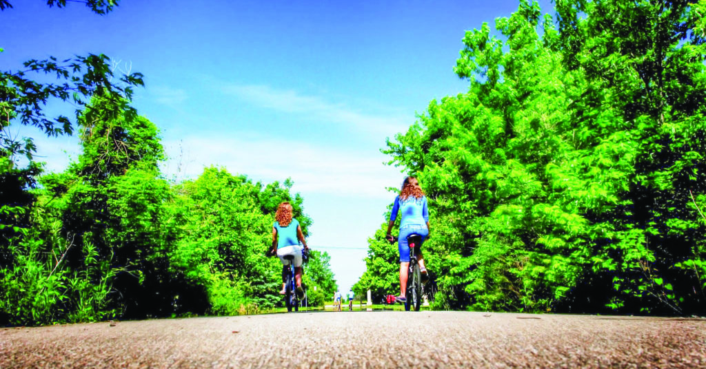
Lodging Deals

trails

trails attractions in Marion, Gas City, Fairmount and Upland, Indiana

Sweetser Switch Trail - Cardinal Greenway - trails near Marion Indiana

Sweetser Switch Trail

The Sweetser Switch Trail is the ideal place for walking, running, bicycling, roller blading and horseback riding. A paved and stoned trail stretches for one mile with beautiful landscaping, benches, shelters, and tables for picnics. The trail includes a 1916 wooden caboose, restored parlor car, and mail car for different recreational events. The Sweetser Switch Trail Pumpkin Walk is held annually in the latter part of October. Located 5 blocks South of State Road 18.

View the attraction page
Mississinewa Riverwalk, Marion riverwalk, riverwalk, trail, path, walking, biking, outdoor activities, point of interest, Marion Indiana

Marion’s Mississinewa Riverwalk

Scenic path that follows the Mississinewa River and stretches for 2.25 miles. The walkway begins at Washington Street bridge and 1st Street, and extends through Matter Park, providing a trail system for recreation and physical fitness.  Walk, jog, run, bike, roller-blade – this paved trail is perfect for all types of activity.  Families and children love this trail!

View the attraction page
Cardinal Greenway, Cardinal Greenway Trail, Rails to Trails, hiking, biking, walking, fitness, trail, outdoor activities, Marion Indiana

Cardinal Greenway

Enjoy biking, hiking, or jogging along 7.5 mile portion of the Cardinal Greenway rail-trail project in Grant County. Major trailheads with parking are located in Marion behind Westwood Square on Miller Avenue between 2nd and 6th Streets, at Hogin Park at Valley Avenue and 14th Street, and in Jonesboro/Gas City at the intersection of SR 22/35 and Water Street, just east of SR 15. No motorized vehicles allowed on trail.

View the attraction page
Salamonie Reservoir, outdoor activities, boating, fishing, hiking, camping, Marion Indiana

Salamonie Reservoir

11,594 acres and a 2,855 acre lake. This property boasts sixty ponds, marshes and wetlands. The name Salamonie was derived from the Native American word “O-sah-mo-nee,” which means “yellowpaint.” Native Americans made yellow paint from the bloodroot plant which grew in great abundance along the winding banks of the riverBe sure to visit the nearby Salamonie River State Forest, which encompasses 850 acres and offers many recreational opportunities to its visitors.

Activities & Facilities

  • Amphitheatre
  • Basketball Courts
  • Biking Trails 
  • Boating / Launch Ramps/ Marina  
  • Bridle Trails
  • Canoeing/kayaking 
  • Cross-country Skiing – no rental
  • Fishing / Ice Fishing
  • Fishing Pier (open when water level permits)
  • Hiking Trails
  • Horseshoe Pits
  • Hunting / mandatory check stations
  • Division Interpretive Naturalist Services
  • Property Interpretive Naturalist Services
  • Mountain Biking  
  • Interpretive Center
  • Picnicking / Shelterhouse  
  • Playgrounds
  • Snowmobile Trails
  • Swimming / Beach
  • Volleyball Courts
  • Waterskiing

Camping

  • Lost Bridge West SRA – Modern Electric Campground / 245 sites
  • Lost Bridge West SRA – Horsemen’s Campground / 50 primitive sites and Apple Orchard campground / 38 sites
  • Lost Bridge West SRA – 7 Youth Tent Areas
  • Lost Bridge West SRA – 2 Dump Stations and 4 Comfort Stations
  • Salamonie River State Forest – Horsemen’s Campground / 15 primitive sites and Family Primitive Campground / 21sites

Online Reservations: http://www.indiana.reserveworld.com/

View the attraction page

News & Events
trails


Upcoming events


News


  | Switch to Mobile Site